The Golden Temple Of The Sikhs

The Golden Temple Of The Sikhs
The Golden Temple of the Sikhs, in the Punjab region of northwestern India.

The Wagah Border Crossing, one of the most contentious borders in the world. I crossed here and spent an oh-so rewarding week inside Pakistan.

Sunday, November 23, 2014

Drums Along The Mekong (#1 in Lao/Cambodia travel series)


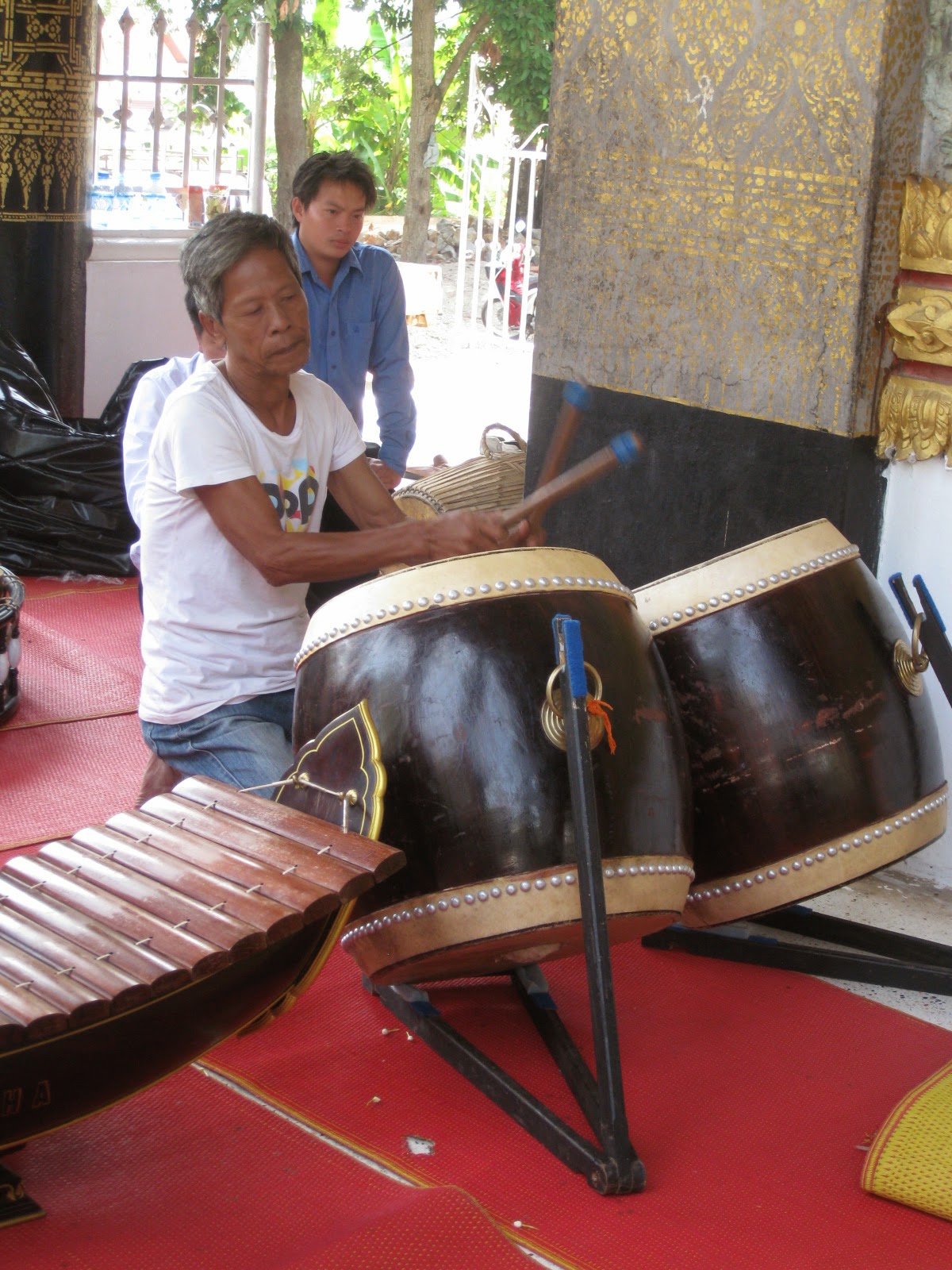
Traditional drumming in Lao.


Well, here I am, Southeast Asia once again.  My fourth time.  I landed in Bangkok Sept. 24 and proceeded north by bus to the famous Golden Triangle region.  Where northern Thailand, Laos and Myanmar (formerly known as Burma) all come together.

In decades past, the area produced a lot of poppies for opium, much of which eventually found its way into the veins of junkies in the Industrialized Nations.  For this reason the area has been portrayed luridly in Hollywood films, with dark plots and lots of blood-spattered savagery.

However, it's turned out to be one my favorite parts of Thailand.  The opium is mostly gone now, though a fair amount of locals still smoke the stuff.

Going north out of Chang Mai, the second largest city in Thailand and a favorite of tourists, you pass through valleys lined with stately green-clad mountains, past butterfly enclosures (for making silk), elephant corrals, snake and fish farms, and fields of corn, lots of corn.  Topography-wise, it reminds me of the Shenandoah Valley of Virginia. 


Your humble correspondent, in the back of the bus.
  

Rice fields along the way.


The scenery was great, especially when the bus topped out on hills clad with jungle, trees and hanging vines, but was it hot.  So hot that sometimes the sap seemed to boil right out of me.  Most locals sought shade in the afternoon and took naps, then re-emerged after sunset to shop, eat out or whatever.

Eventually I made it to Chiang Khong, a little border town along the Mekong River...as far as you can go in Thailand.  It's sunset now and across the way, across the brown and swirly flow, drums are beating out time to tribal chanting.  Probably the Hmong People, I'm told, who inhabit that part of Lao. They say that it's a different world over there, a different culture anyhow, and from where I stand this tranquil evening it certainly sounds it.


The riverfront at Chiang Khong.


Chiang Khong itself is the consummate border town -- a little rough around the edges but emanating an air of excitement and anticipation.  Vehicles are spattered with mud or coated with reddish dirt.  Many of the people are Thai, but many also are hill tribe, with crinkled, prune-like faces and brownish teeth from chewing betal nuts and various roots and herbs.  

Into this mix, toss the few odd "felongs," which is what they call white foreigners or tourists, and you get an idea of Chiang Khong -- Boggie in a ball cap mingling with friendly natives in need of dental work.  I found a nice place to stay and settled in for a few days.


 A hill woman displaying her produce.


Maleewan, the Thai woman who manages the guest house I'm staying at, describes her job:  "This is my mission -- to feed and house felongs.  So they will not be hungry on the way to Lao."

Indeed, that's what she and her staff do -- their guesthouse is a way-station, a last stop going into the so-called People's Democratic Republic.   In reality, Lao is Communist-run and has been since the fall of Saigon in 1975.  Hardly a real Republic.

Loudspeakers across the river demonstrate this every morning:  At 0500 they blare forth with rousing music and Commie-style propaganda, urging Laotians to rise up and go forth to labor for the betterment of the state, or some such thing.  Kind of a comrade-worker alarm clock. 

A lot of us at the guesthouse found this amusing -- except that the exhortations jolted us awake at 5 A.M., too.  From all the way across the river!


The dining area at Baan Rimtaling Guesthouse.
 

Maleewan, of Baan Rimtaling.


By the way, a bunk in the dorm there goes for 100 Baht these days (about $3 U.S.).  It's a little on the rough side, but the view of the Mekong is excellent and the house green curry is to die for.  It's reasonably priced as well, as is the whole menu. 


At 32 Baht to the dollar, you can figure it.


I was quite taken with Baan Rimtaling; the ambiance, the people staying there, the view of the river, etc., and would like to have lingered there longer.  But I was on a mission, of sorts, to proceed downriver through three countries:  Thailand, Lao and Cambodia.  To accomplish such things, I've learned, sometimes you have to keep movin'.

As the drums beat on across the Mekong, Maleewan admonishes her cats: "Hey, you behave or I take you all to Lao."  As for what they do with them over there, well, let's just say that most aren't kept as pets -- for long.

To explore these and other such rumors, in a day or so I head on over there myself.  Will have details in my next report.


Lao across the river.


[PART TWO TO FOLLOW NEXT WEEKEND]


Sunday, March 2, 2014

Cocibolca (#3 in river series)


Preparing to get underway.


Aboard the good ship Gustavo Orozco, about to shove off on its regular Friday run north, all hands were in a festive mood.  

Passengers who had been strangers lugging backpacks on minutes before were chatting each other up like old friends.  Captain and crew flitted around us like social butterflies.  It was like the commencement of an ocean voyage, and in a sense it was just that.

With departure at 1700 from San Carlos, it would be thirteen hours across the lake to Granada, with a stop at Ometepe Island for passengers and cargo.  An all-night steam through what was essentially a small, inland sea.


Known as the Mother Lake of Nicaragua, it is the most revered place in the entire country.  Early inhabitants of the area called it Cocibolca, which means roughly clear waters, good waters.  The Spanish referred to it El Mar Dulce, The Sweet Sea.

The largest lake in Central America, at a hundred miles across, the water is anything but clear or sweet now.  Urban sewage and agricultural run-off have taken their tolls, and the color is more brownish with an acrid odor than clear. 

Nonetheless, it's a huge expanse of fresh water, and provides host for a variety of wildlife and fish , including tarpon, sawfish, and sharks...yes, sharks.

Bull sharks have been proven to exist in salt or in fresh water worldwide.  In this case, they migrate in and out of the lake using the Rio San Juan.  Coming in from the Caribbean, they've been observed jumping the rapids at El Castillo almost like salmon. 

As stunning as it may be on a sunny day, with sparkling surface and imposing volcanic islands, Cocibolca is not always a gentle giant.  It has a reputation for lashing winds and powerful, even violent storms, whipping up almost out of nowhere...something that we were about to find out.


Good-bye to San Carlos.


Calm conditions as we make for open water.


A type of segregation was practiced aboard the Orozco.  Foreigners, or tourists, pay nine dollars U.S. for the passage and ride up on the second deck.  Locals, or Nicaraguans, pay less and go to the first deck.  This is designed, I think, to give the Nicas a break financially.

However, the way that it plays out -- fewer people are up topside, so you can spread yourself out and it's more comfortable.  But being higher up, the motion of the boat is worse up there, too.  Often much worse.  In other words, when heavy weather strikes, the second deck is not the place to be.

We found this out about four hours into the voyage:  Instead of hatches being closed with a clang and latched, suddenly they were slammed by fierce winds.  People were stumbling across the aisles or sprawling outright across bench seats due violent actions of the boat.  

I looked out to see us battered by angry waves, the tops churned white by the winds.  My god, I thought, it's like the North Atlantic. 

As the night wore on, we picked spots on the cushioned benches to lay out and did our best to sleep.  But the constant pounding on the hull and creaking and crashing about the boat made it difficult.  I laid out with my head below a window, only to have smelly water dripping down onto my face.  Splash was flying up all the way to the second deck, then leaking past the rubber liner! 

The only passengers on their feet were the ones bolting for the marine heads, faces pale, palms cupped in front of the mouths.  So much for the festive mood of earlier. 


The wharf at Ometepe -- in calmer conditions.


Near midnight, the stopover at Ometepe Island provided a welcome respite.  Waves were still impacting ship and shore, but at least we were tied up now, not ploughing through them.  The captain had swung us into the concrete pier nicely enough -- quite a feat considering the howling conditions.  However, still reacting to the extreme motions of the boat, hardly anyone got up.

Eventually I managed to my knees, to peer out the window -- and see one of the strangest sights of all my travels: 

Dockworkers were tromping the gangway; hunched forward, bunches of bananas across their backs.  Bathed in moonlight, showers of spray exploding about them, they were like worker ants stocking up a colony.  A volcanic mountain, easily visible in the full moon, loomed in the distance, and added to the eeriness of the scene.

After about an hour, we chugged back out -- and into the ongoing tempest.


Banana boat -- at the wharf in Granada, finally.


Like some kind of swarmy cosmic joke, we made Granada approximately as the wind died down.  Those of us who had been up topside staggered off and practically threw ourselves onto good ol' Mother Earth.  The Nicas, who rode it out closer to the boat's center, had a better time of it.  Most of them walked off gabbing and with a spring in their steps.

Oh well.  You'll have this once in a while, I've found, seeing the world -- a rough patch now and then.

So we wobbled off into the gray dawn, toward the steeples of Granada, a wonderful colonial-style city in its own right.  However, as good as the food is there, and inexpensive, I doubted that I'd be eating any for a while.


The square in Granada.  Carriage ride, anyone?


The End


Sunday, February 23, 2014

Of Chinese Canals And Spanish Treasure (#2 in river series)


For those of us who like to travel on rivers, San Carlos is a sort of a double bonus.  Maybe even a trifecta.

It's situated where one river, the Rio Frio, empties into Lake Nicaragua, and where a larger one, the Rio San Juan, empties out and winds all the way to the Caribbean, some hundred-and-twenty miles distant.

For those of us who like history as well -- the place is awash; in fact, it fairly laps at the shores.  Some peoples of note who passed this way:
  • The earliest Americans, who settled there thousands of years ago.
  • The Spanish, who sailed upriver from the Caribbean, crossed the lake and established a city, Granada, on the northern shore.  
  • The Buccaneers, who later sailed up the same river to rob and rape said city. 
  • The English, who came to lay siege to a Spanish fortress along the way.
  • And more, much more.
Wow, talk about a past!  After a few hours exploring San Carlos, as boisterous and busy of a river town as I've ever seen, I heeded the call and headed down the San Juan.


Loading up to head downriver.


Hutch along the way.


A half-mile wide in some places, I discovered that the San Juan is both substantial and interesting to boot.  For we river explorers, a real bonanza.

Nowhere is that more evident than downriver at El Castillo or "the castle."  Named after the Spanish-built fortification that presides over the area, it is perhaps the consummate river town because no roads lead into the place; it's come by river or perhaps drop in by parachute, or else forget it.


El Castillo


Completed in 1675, La Fortaleza, as the fortress itself called, was placed there to stop pirates and other enemies from proceeding upriver to cross the lake and raid Granada, which had become a repository of Spanish treasure.

La Fortaleza sets atop a hill overlooking a stretch with rapids -- a seemingly strategic location.  Any boats approaching could be raked with cannon fire.  In addition, the waterway was then infested with crocodiles and sharks, which migrated upriver from the Caribbean en route to Lake Nicaragua.  It made for a dangerous place to have to take a swim.

Despite all this, the fort was conquered by successive waves of raiders, and the riches of Granada plundered again and again.

Nevertheless, give the Spanish their due -- it took a Herculean effort to build it out of that wilderness, and even centuries later it's still an impressive structure to tour.


La Fortaleza


Street in El Castillo.


Seen about town.


You can tell a lot about a place by just walking around, I've found.  Or as Yogi Berra used to say, You can observe a lot about people just by watchin 'em.

El Castillo is the residents going through the morning ritual of sweeping the sidewalks with bundles of straw lashed to sticks.  It is a pig, squealing for dear life, being dragged through by a rope...a woman doing your laundry in the river for $2 U.S., and then hanging it out over bushes and banana leafs to dry.


Woman doing laundry in the San Juan.


It's a mounted vaquero or cowboy romping alongside cattle across-river...or sitting on the porch of the Hotel Victoria watching the flow in the moonlight and listening to a chorus of frogs rise to a crescendo, then fall off -- over and over again.

It's the white linen napkins at the Victoria house...where the whole grain bread comes hot out of the oven and is served with scrambled eggs and tart blocks of cheese...and where the mango juice is served in stem glassware and a single room goes for $16 U.S. per night.

In case you're wondering, in this part of the jungle that 16 U.S. gets you wood paneling, air-conditioning and your own bath.  

Usually I stay at hostels for half that price, for a bunk in a dorm room.  As my father used to say, I was the last of the big-time spenders.  But for those couple of nights in El Castillo, I indulged.  (I don't know.  It just seemed right.)


Your humble correspondent in the lap of luxury.


Magdalena, manager of Hotel Victoria.


Main means of transport here.


Downriver from El Castillo, more history -- the skeletons of paddle wheelers lie in the undergrowth; beams rotting away, their boilers and piping encrusted with rust -- relics from that great American entrepreneur Cornelius Vanderbilt.

Back in the 1800s, he set up a system to ferry 49ers from the Caribbean to the Pacific, and then on to the gold fields of California. This very river, as well as those paddle wheelers, were part of it.
 
Which brings us to present day and possible history in the making:  Our old friends the Chinese want to build a canal through Nicaragua, a rival to the famous one through Panama.  One proposed route would use the San Juan, like Vanderbilt did, cross Lake Nicaragua, and proceed to the Pacific from there.

Another proposal, the most favored one, would use a river farther up north.  As of yet, it's undecided, as far as I can tell.  But supposedly a deal was struck and construction is to start in December.

We shall see.


Could massive freighters someday loom in out of these mists?


Red Hibiscus


At any rate, far too soon, it was time to move on.  I had a date, shall we say, with another body of water, alluring in its own right -- Lake Nicaragua.

I had decided to head back upriver to San Carlos and go for an all-nighter across the lake.  Little did I know what lie in store.  Even for an old Coastie, supposedly accustomed to such things, it turned out to be one helluva time.


Last look at El Castillo -- where even the dogs were friendly.


[Part Three to follow, next Sunday, March 2]


Sunday, February 16, 2014

Jungle River To Nicaragua (#1 in Central America river series)


On the Rio Frio, heading toward the border.


Besides all of its natural wonders, Costa Rica has some interesting border crossings.  One of these, on the southern end, is detailed in a previous blog post, "In Search Of Panama Hats."  Another, even more out-of-the-way, I traveled this year.  It's located on the northern side, where C.R. butts up with Nicaragua.

To take advantage of low airfare offered by AeroMéxico ($268 round-trip out of NYC) I flew on New Year's Eve and landed in C.R. on Jan. 1.  It meant that I was 40,000 feet up when the ball dropped, but who cares?

After two weeks in San Jose, the capital, where I got dental work done, visited Dr. Montero, one of my chiropractors (the other is in Montrose, PA), visited with friends, made the rounds of various hostels, casinos, restaurantes, etc., I was ready for something -- something adventurous, that is.  Los Chiles came to mind, a little town on the northern frontier where you can transit into Nicaragua. 

I had wanted to go that route for years.  Mainly because I had heard that there was boat travel involved, and with such things I cannot help myself.  So I arose in the night like a ghost and caught the 0530 bus for Los Chiles.


Waiting to get passports stamped at Los Chiles, Costa Rica.


The bus trip, five hours, was the kind that I've come to love -- the road wound past sweeping green mountains, providing wonderful vistas of the countryside, and slowed through neat little towns or pueblos, as they call them here, providing glimpses of local life.  So it was a look at C.R. that I've  never seen.  

In addition, the bus was full, with people standing in the aisles, yet I was the only gringo or white person on board!  With the country a-swarm with sunseekers, backpackers, and the like this time of year it was a nice respite from the tourist zones.

A lot of the passengers were Nicaraguans (Nicas, as they're called) heading across the border to visit relatives or simply return home.  For whatever reason, I've always hit it off with these people, and this came in handy because some of them helped me with getting through immigration.  I speak some Spanish now but with officials barking orders and directions, demanding money for this and that, it's hard to figure out what's what and not get scammed.   

Eventually, though, we got through and headed for a brown, sluggish river down the road from inmigración -- the curiously named Rio Frio. 


A river ferry coming in at Los Chiles.


The name is curious because Rio Frio means "cold river."  However, it's about warm as wash water, as least when I was there.  Yet it's what makes this border crossing unique.  The river is the "highway" leading up north, across the international border -- the only way to get there.

It's not a scenic tour, as such, but it could be:  You cruise through trees and dense jungle alive with monkeys, sloths, cranes, storks, turtles with the most colorful heads I've ever seen, fish, including tarpon and snook, caymans, which are a type of crocodile, and more. 

In the wish-that-I'd-had-my-camera-ready department, we passed a dozen iguanas laying out on a branch, warming themselves in the sun.  They had a yellowish, even gold-like cast to their skin and would have made quite a picture. 

Generally though, I just sat back with mouth open, taking it in... 


Some kind of herons, I think.


Nicaraguan military shake us down mid-voyage.


Reminds me of the Upper Amazon.


As trying as they may be sometimes, I like to cross these borders.  Often you have to wait for hours in the sun outside immigration, only to be grilled by authorities or hustled by shysters posing as officials, but they can be quite the travel experiences.  

Call this one a border crossing with elements of a nautical safari.  Other such transits are scattered about the Lower Americas, but this was certainly noteworthy.

All good things must come to an end, and this one came to a rather grand one.  The Rio Frio empties into spectacular Lake Nicaragua, about a hundred miles across.  Quite a sight, after being on jungle-enclosed river for so many miles, to be unfolded onto that massive body of water.  Our boat steered toward a town simmering off in the distance, San Carlos. 


San Carlos, from the mouth of the Rio Frio.


Reception committee at Nicaraguan immigration.
 

We were entering another country, of course, so we had to pass through immigration there.  Under the watchful eyes of soldiers with AK-47 rifles, we hauled luggage off the boat and sweltered for an hour or so in line. 

Eventually the AKs were slung across their backs and they became absorbed in their cell phones, like much of the rest of the world.  I paid my twelve dollar entry fee, got my passport stamped, and wheeled my duffel out into rollicking, little San Carlos, to begin Part Two of my Nicaraguan river adventure.


San Carlos dock, with Lake Nicaragua beyond.


[Part Two to follow next Sunday, Feb.23]


Monday, November 18, 2013

In Search Of Panama Hats, Part III


Along the Avenue of the Volcanoes.


It came to me up toward the top of Ecuador -- a revelation.  I was hopping buses at the time along the famous Pan-American Highway, a stretch known as the Avenue of the Volcanoes, when the trip became more than simply about hats.

Sometimes, here and there, I could catch glimpses of the peaks -- Cotopaxi, near Quito, at 19,347 ft; Tungurahua, towering over the resort town of Baños, at 16,500; and the highest of them all, sacred Chimborazo, at 20,702.  As well as others.

Tungurahua was giving off a steady plume of ash, while glowing red at the tip at night as if the mountain itself was perpetually toking on a cigarette.  Almost all of them were snow-capped, with symmetrical cone-shapes, like helpful pyramids marking the way along the High Andes.


For days the peaks had been playing peek-a-boo with me through swirling clouds and rain showers -- maddening for someone trying to take decent pictures.

Disappointed, I happened upon a religious pamphlet at a road station, with a definition of the word pilgrimage:

"...a journey, especially a long and arduous one, made to some sacred place as an act of religious devotion."


Fellow travelers on the bus.


Quite honestly, if I had just wanted Panama hats I could have gotten them in the country of Panama or back in Cuenca.  No problem.  And for less money than elsewhere because so many of them are made there.  

As it turned out, I didn't just want Panama hats -- I wanted their history, their roots, their core.  Actually I was on my own pilgrimage, of sorts, which is why I descended those mountains and endured that god-awful stretch of Ecuadorian coastline.


 A street in Montañita -- tourist trap extraordinario


Indeed, the beach towns that I visited were some of the biggest holes that I've ever landed in -- Montañita, Puerto López, etc.  I didn't leave them as much as flee them ASAP.  I can't say that I wasn't told -- other trekkers had warned me.  But Montecristi, the veritable Mecca of Panamas, was but a few miles inland, practically en route, so I thought that I'd breathe a little salt air first.

On these trips, I've learned, you have to go with it...go with the flow.  And the flow was spurring me away from the squalor and grayness of the coast, toward the interior, where the sun finally shone through.


The plaza at Montecristi.


Your humble correspondent -- under the big sombrero at last.


What interested me there as much as anything were the straw cutters.  Even now, in the 21st Century, they're still guided by the moon.  For five days in every lunar cycle, after the moon reaches its waning quarter -- then and only then -- do they machete down toquilla, the ten-foot-tall, palmlike plant from which the hat is woven. 

However, it's more than mythology:  The straw holds less moisture then and thus is lighter, easier to cut, and more pliable to weave.  It's something that has been learned through the centuries.  It's what gives Panamas, the genuine articles, that light-as-a-feather feel, that cock-of-the-walk attitude, that combination of style and practicality which virtually oozes of the tropics when you see one.

WOW! I recoiled, now this is what they do when you get to the source of something:  myths, lore, trivia, facts to amaze, and, of course, making them.  After drying and sorting and aging, the palm is taken to places such as this...


Glenda Pachay in front of her family's home/hat shop.


Regular households, really, which are scattered throughout Montecristi.  These are where the real work is done here, where the superfinos are made.  For some models, the artisans can take two months to make and the weave is so tight you can tip them upside down and they'll hold water!  In fact, locals used to use them to haul water.

Pop one of these babies on and look in the mirror -- you can see why they've become a fashion statement.  Not only does your look change but your disposition as well.  I angled my head higher, acquired a little strut in my walk.


 Flerida Pachay Anchunida at work inside.


For my purposes anyhow, Flerida Pachay about did it.  Spending time with this master hat maker and her daughter Glenda was both informative and a true delight.  Plus I came away with a sense of closure.  The mission was now completado.

Their household, and dozens of others in Monetcristi and nearby, are where the tradition of Panamas began, and where it continues to this day.  I had seen the process from top to bottom, and had even trod the dirt from whence they are grown.

Through this last month, seeking them out had been a true adventure, travel at its best.  Like all such endeavors, it had its ups and its downs.  But boy, what a pay-off.

Now all that was left, I decided, was to buy a few.


Back home with three different styles.


Finally, a travel thought:  Ecuador uses United States dollars as the national currency, which cuts down on some of the stress of traveling as you don't have to change money when you arrive, you aren't charged extra fees for credit card transactions, etc.  Which makes it nice and simple.

Un saludo a Ecuador for that!


THE END